Hail swath maps for every storm, and an alert when hail hits the places you work.
 Hailmark: Hail Swath MapsHail swath maps for every storm, and an alert when hail hits the places you work.
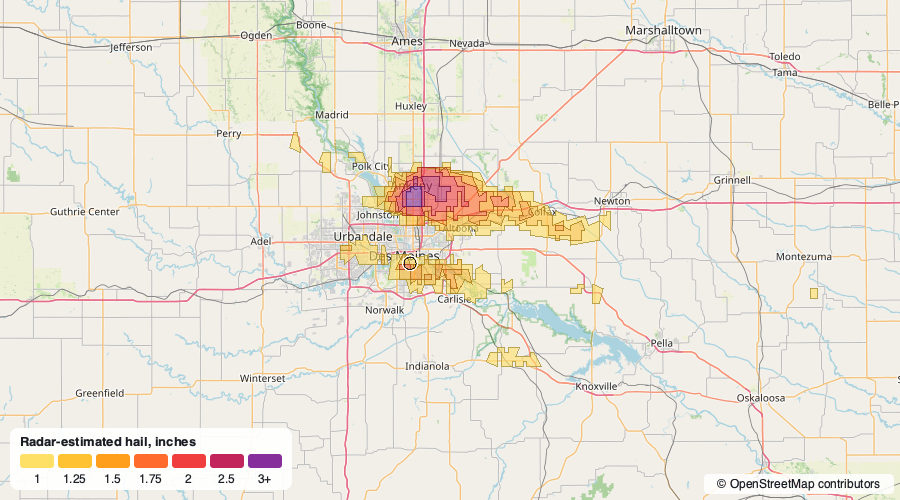
Hail map, September 9, 2026: Des Moines, IA
Radar-estimated hail in the 24 hours before the morning of September 9, 2026, with hail of 3" or larger near Des Moines, IA.
Where it hit
- 3" or larger near Des Moines, IA
How to read this map
The colors are NOAA's radar estimate of the largest hail that fell (MESH, from the MRMS system), drawn as swaths by size. Radar estimates can run high or low; for an insurance claim, pair them with a roof inspection and the National Weather Service's ground reports.
Base map: OpenStreetMap contributors. Hail data: NOAA MRMS.